 RaceAtlas
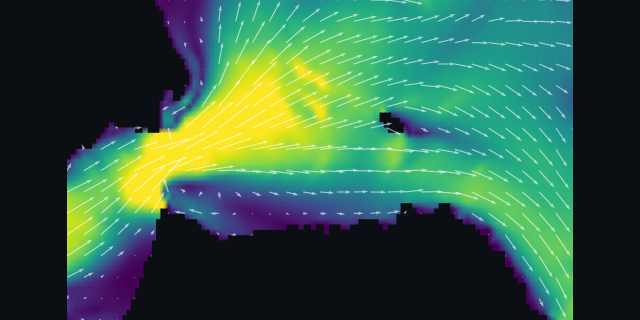 The Gate at max flood, 2.8 kt
| Time | Height | |
|---|---|---|
| 2:56 AM | Low | 2.7 ft |
| 9:06 AM | High | 6.4 ft |
| 3:59 PM | Low | -0.7 ft |
| 11:01 PM | High | 4.8 ft |
| Time | State | Speed |
|---|---|---|
| 1:39 AM | max ebb SW (235°) | 0.8 kt |
| 3:42 AM | slack | – |
| 6:45 AM | max flood ENE (074°) | 2.8 kt |
| 10:06 AM | slack | – |
| 1:04 PM | max ebb SW (235°) | 1.7 kt |
| 5:00 PM | slack | – |
| 8:19 PM | max flood ENE (074°) | 2.8 kt |
Not for navigation. These are harmonic predictions, not live measurements. Tide heights: station 9414792 (Alcatraz Island). Currents: station SFB1203 (San Francisco Bay Entrance, Golden Gate). · RaceAtlas, the SF Bay current atlas.